Chancho Igziabher
Chancho Igziabher was established some three decades ago
on what was a traditional religious site. Most native trees have been removed
from the top of the hill, but much woodland remains on the slopes. The
undergrowth is scarce and regeneration is absent. Several patches of eucalypts
exist and this species is favoured because of its economic value.
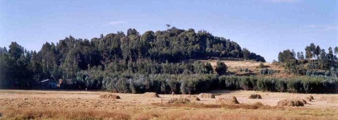
Chancho is located on a plateau to the North of Addis
Ababa at the edge of a large treeless plain. The church is found on the top of
a small hill to the West of the town at an altitude of 2600 m asl. The land
controlled by the church is clearly divided into a number of zones with
different uses. They are:
'inner' churchyard
(churches and housing)
'outer' churchyard
wooded graveyard
natural woodland
eucalypt plantations
grassland
habitations
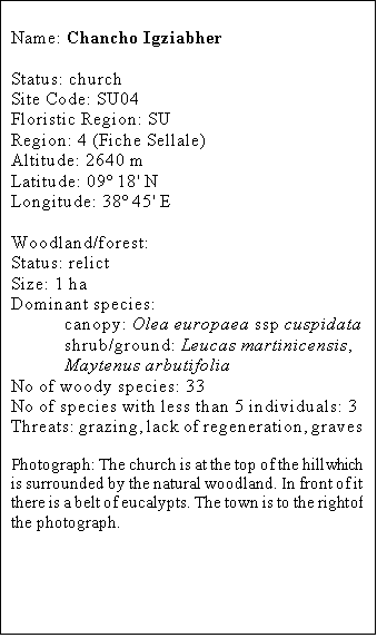
The woodland canopy is
mostly composed of Olea europaea ssp cuspidata and the shrub layer is absent.
Much of the hill to the northern side is bare of native trees and consists in a
mixture of grassland and eucalypt plantations. These generate money for the
church especially as they are trying to complete the building of the new
church. They have secured 17,000 Birr in the sale of Eucalyptus trees twice in
12 years. The woodland resources, but eucalypts in particular, are perceived
more as a source of revenue than as a place of religious significance.
The surrounding vegetation is dominated by
grasslands and eucalypts. Only a few native trees remain at a traditional site
on the summit of an adjacent hill.
History
The church was established in 1970 on the site of a
traditional Oromifa sacred ground. It has been reported that at the time the
landlord allocated the traditional religious sacred woodland to a priest so
that an Orthodox Church could be established on the top of the hill. A new
church is currently been built.
The hill was formerly fully covered by natural
forest dominated by Olea europaea ssp
cuspidata and some Acacia sp., but since the establishment
of the church most of the native vegetation of the hill's summit has been cut
down. The nearby hill of Buba, harbouring a traditional sacred site, has fared
even worst with hardly trees surviving.
Conservation status
For this region this woodland represents one of the
last remaining tracks of native vegetation. A hammerkop nest was found in the
woodland.
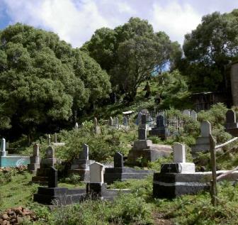
The woodland understorey is nearly totally denuded of
shrubby vegetation. Note the corrugated iron roof on the far grave.
The western type of grave are nearly solely found outside
the woodland hence not presenting a threat to the tree’s survival. However, as
tree planting is not a local tradition there is no woodland expansion.
Threats
Heavy grazing by
livestock is suppresing the natural regeneration of trees and prevents the establishment
of a shrub layer. A shift in burial practices from traditional to western
style, if carried out under the canopy of native trees, may result in crown
dieback. The replacement of native species by income generating eucalypts could
become a major problem.
Management
Access to livestock
should be prevented and the western style of graves should only be established
outside the woodland. The promotion of tree planting, as practised in much of
the country, should be favoured in order to expand the woodland area.