Kidus Georgis
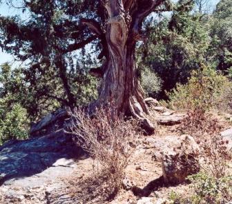
A long but narrow forest spreads along the steep slopes below a limestone
pavement. Kidus Georgis forest is dominated by Juniperus procera but a variety of other woody species form the
canopy below the main cliff. Although somewhat controlled, levels of grazing by
livestock are not sustainable and in recent times have lead to severe soil
erosion.
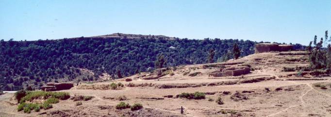
On the top of a mountain range running North-South
there is an East West escarpment below a limestone pavement. Kidus Georgis 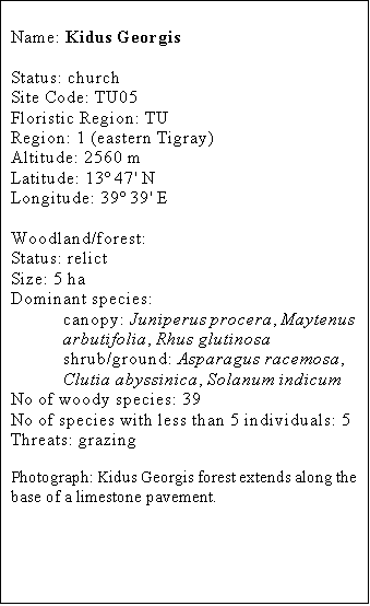 forest spread along most of these steep slopes. The church is located
not far below the cliff towards the West. To the East there is a major mule
track ascending to the plateau.
forest spread along most of these steep slopes. The church is located
not far below the cliff towards the West. To the East there is a major mule
track ascending to the plateau.
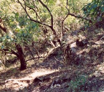
The forest structure and composition both change
with elevation. Right below the limestone pavement at the bottom of the cliff
there is a mixture of woody species.
Further down Juniperus procera
becomes dominant and towards the base of the slope the stand becomes an open
woodland and eventually turns into open grassland. In many parts of this site
the canopy is rather open. Much of the woodland is heavily grazed and little
tree regeneration is observable.
The region of eastern Tigray has a high density of
churches, many of which have scrub or even woodland. Outside these areas native
woody plants are rare and the landscape is dominated by eucalypts when tree are
present. The limestone pavement at the top of the mountain is pretty barren,
whilst the land around the base of the forest is either cultivated or is
extensively eroded (i.e. slopes).
History
This church is at least 100 years old but little is
known about its history. It is found in a region with many churches including
some of the best-known rock churches of Tigray. The mule track crossing the
forest is well worn and quite old.
Unlike any other site visited, the local community has
some understanding of the problems grazing can cause in terms of tree
regeneration and soil erosion. They have enforced a limit to the number of
people, who can use the forest for their livestock, however they do not appear
to have set a limit to the number of animals that can graze.
Conservation
status
This is an important track of forest in a region
where forest cover would have been removed long ago. The heterogeneity of the
forest along the slope gives the woodland a special feature not observable
elsewhere.
In the lower part of the woodland where Juniperus procera dominates the canopy there is severe erosion
around both shrubs and trees. This results from overgrazing.
The zone right below the cliff is nearly devoid of Juniperus procera.
Threats
Although in some ways
controlled, grazing pressure goes far beyond the carrying capacity of the land.
Severe erosion occurs in the lower half of the forest. Most trees and shrubs
now grow on hummocks with most or all soil in between washed away. This clearly
indicates that this erosion has been taking place since these plants became
established, suggesting that grazing pressure has increased during the latter
part of the 20th century.
Management
The community needs to address the question of
grazing rights and how to reduce the number of livestock using the forest
during various seasons of the year. This issue is obviously related to the
scarcity of pasture in the area and a recent run of years with below than
average rainfall.